Uganda faces increasing pressure to restore degraded landscapes and meet the rising demand for sustainable timber and biomass. To support these efforts, GeoIQ Partners conducted a tree species suitability analysis for the northern region of Uganda. The goal was to identify where species such as eucalyptus, bamboo and grevillea can thrive under current and projected climate conditions, while accounting for socio-economic and environmental dynamics.
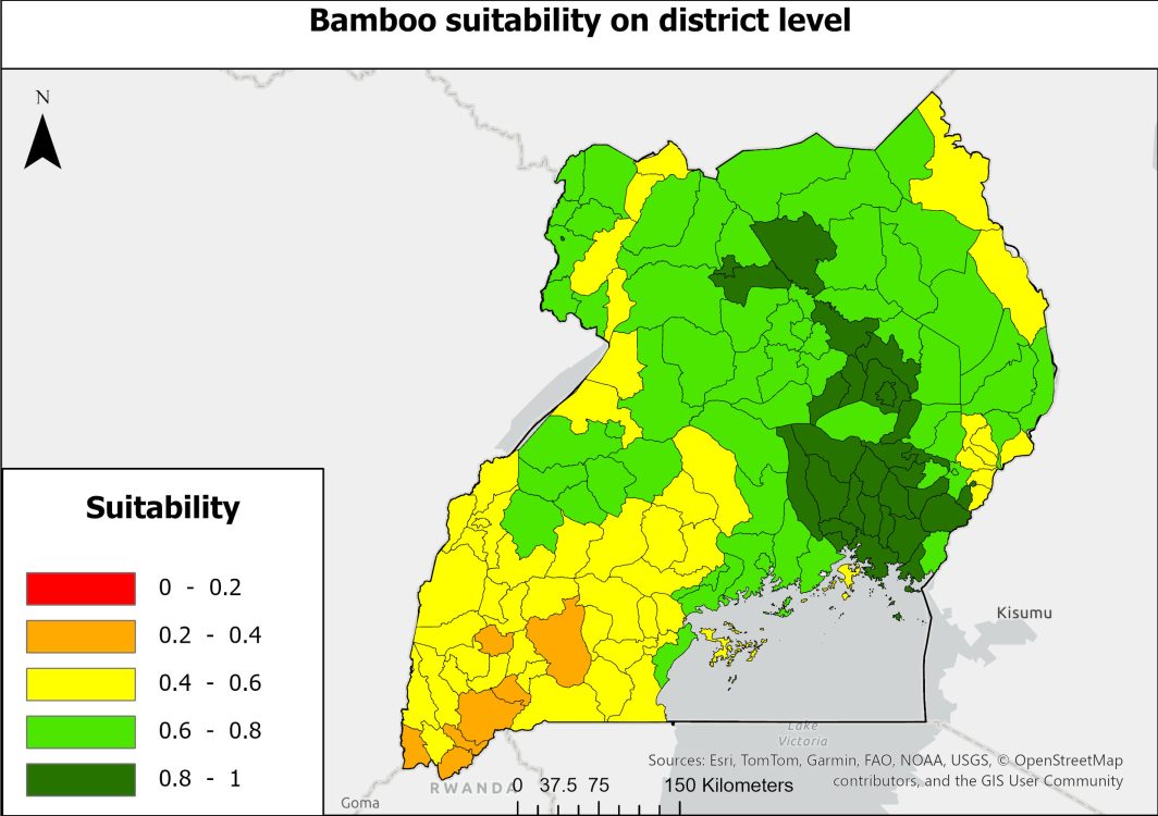
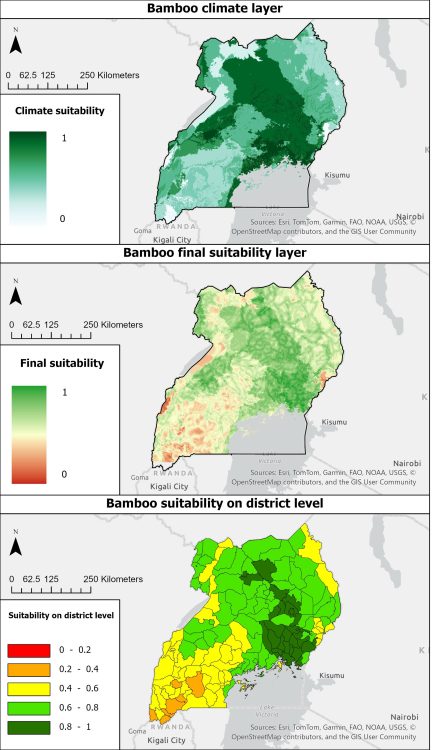
Using a Multi-Criteria Analysis (MCA) framework, the study combined variables such as rainfall, temperature, altitude and poverty rate. Each parameter was classified, weighted and aggregated to generate suitability maps that rank each district for multiple tree species. These maps highlight priority areas where environmental conditions and social development potential intersect.
Challenge
The main challenge was integrating climate and topographic datasets with socio-economic indicators across districts that vary widely in data availability and quality. Another key difficulty was finding the balance between maximizing ecological suitability and promoting equitable livelihood opportunities in rural communities.
GeoIQ deliverables
District-level suitability maps for eucalyptus, bamboo, grevillea and other species
Analytical framework integrating climate, elevation and socio-economic data
Technical report and dataflow diagram describing the replicable workflow
Impact
The analysis provides decision-makers and development partners with actionable insights on where to focus tree planting and restoration initiatives. By aligning ecological potential with local livelihood needs, the study supports Uganda’s reforestation and climate adaptation goals. It also illustrates how geospatial intelligence can guide sustainable land-use planning and resilience strategies across East Africa.
") view
view
 view
view